aaa Victoria falls national park, part of the KAZA transfrontier park

Victoria Falls national park, Zimbabwe, Part of KAZA transfrontier park

One of natures greatest spectacles, the Victoria falls lie within the national park that takes its name, and in turn is part of the vast Kalahari Zambezi Transfrontier park. The area around the falls contains a wealth of wildlife, Covering a total area of 56 000 hectares, both parks lie on the southern bank of the Zambezi River which forms the border between Zimbabwe and Zambia. There are a number of picnic and fishing sites available. Activities include guided tours, walks, day and sunset cruises, game drives and adventure activities.

The Rainforest – Here visitors can see unique flora and fauna. Bird species and small mammals may be spotted beneath the forest canopy whilst following the paths through the groves of Date Palm, Fig and Mahogany.

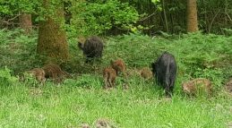
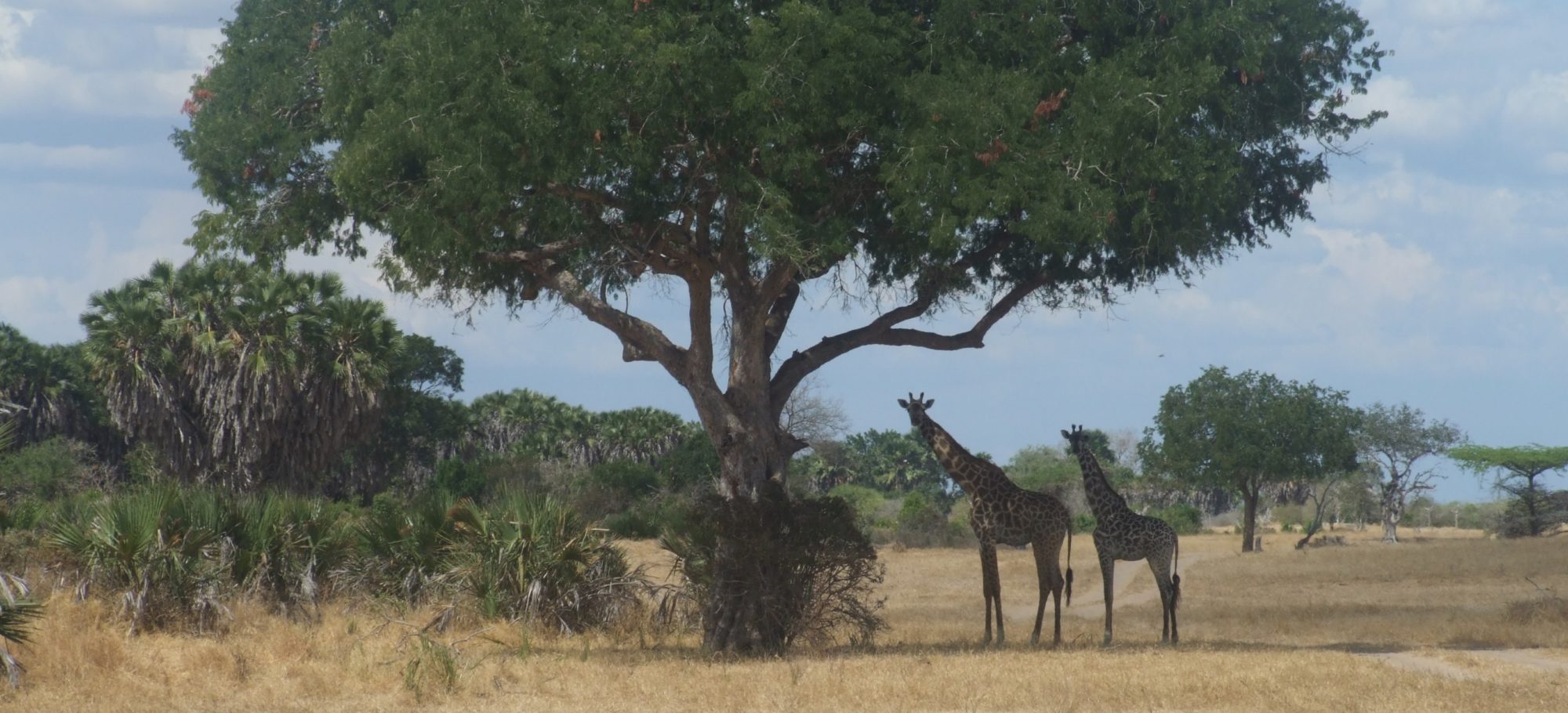
The Game Park – Elephant, Lion, Buffalo, Leopard and White Rhino (the Big Five) can be seen in the park as well as herds of Eland, Sable Antelope, Zebra, Giraffe, Waterbuck and Kudu amongst other smaller species. The Zambezi River is known for its Bream and Tiger Fishing. There are two game drive routes, one accessed through the main gate and the other from just outside town on the Bulawayo road.

aaa Sierra Pampeanas

Sierra Pampeanas, Argentina

This area of parched hills in north-west Argentina, there is a world heritage site. This is of particular interest as the unique conditions and geological formations in the two national parks which make up this area, lead to the most complete known fossil record of plants, dinosaurs, and mammalian ancestors. The two parks together add up to an area of a little over 1000 square miles.

Patagonia, Argentina and Chile, the Nahuel Huapi national park and the Los Glaciares in the South Patagonian Ice field

Patagonia including Nahuel Huapi national park and the Los Glaciares ice field, Argentina and Chile

Patagonia is to the east of the Andes, and overshadowed in the nearer parts, however, covering 900,000 square km, or 347,000 square miles, it is vast and is not all protected. Economic activities in the area have included mining, whaling, Agriculture (sheep and wheat growth) as well as extracting oil.

The northern lakes area of the Argentina lake district has a few national parks in the foothills of the Andes, and are stunning to visit. The southern lakes adjoin the Los Glaciares national park. This area has hundreds of glaciers, which remain from the original vast ice sheet that covered this area. The most famous is Perito Morena. This is 5km across its face (3 miles). It occasionally advances across Lago Argentina and blocks it until the mass of water held back behind this frozen dam becomes to great and it ruptures, crashing into pieces as the water surges through. Another of these national parks is the Nahuel Huapi national park which covers 2700 square miles, and ranges from 700m up to 3000m. With a variety of habitats from grasslands to rainforests. Similar wildlife to the other reserves in this area.

With a range of habitats from high volcanoes to pampa and beaches means that there are many varied wildlife species.  While Condors fly overhead, emperor penguins rheas hummingbirds, flamingoes, steamer ducks, upland geese and long-tailed parakeets. Land mammals include the Brazilian fox, Guanacos and cougars. 

The Los Glaciares national park is in the Southern Patagonia ice field. This contains the third largest ice sheet in the world (after the Arctic and Antarctic). It covers 1720 square miles (of which more than 1 third is covered in ice. 47 large glaciers as well as 200 smaller unconnected ones. Normally occuring above 2500m, here they are found as low as 1500m making them some of the more accessible in the world. The park is dominated by 2 lakes. The range of habitats, from volcanoes to pampa and beaches mean that it has a huge variety of wildlife.

aaa Valdes Peninsular

Valdes peninsular

The Valdes peninsular is a huge axe shaped slab of rock which sticks out 62 miles into the Atlantic from the coast of Argentina. With an area of 1390 square miles, and despite looking barren supports a surprising array of wildlife. Marine mammals include colonies of Southern elephant seals, fur seals, southern sea lions, penguins dolphins and orca congregate on shore and around the coast.

Despite looking barren, the rock does have 130 species of plants growing on it. Guanacos graze here, and live alongside hares, harbour Rheas, Grey foxes, and even wildcats. There are also around 180 species of bird from both marine habitats and further inshore.

Lauca World Biosphere reserve

Lauca world Biosphere reserve, Chile

Lauca World Biosphere reserve, Chile, is the most most extensive plateau outside Tibet and one of the most beautiful in Chile. Fauna that include Vicunas, Guanacos, Vizcachas, foxes, Quirquinchos, Pumas, Tarucas, Tarcus, Suris, Nandus. On top of this, there is a wide range of bird (more than anywhere else in Chile) which include flamingos and Guallatas.

Atacama desert Chile

Atacama desert, Chile

The Atacama desert is the driest place on earth, with an average rainfall of just 1mm per year. The desert is at 2km altitude. While just 94 miles wide, it is 625 miles long. The main reason for its small rainfall, is that the Andes on one side causes all clouds to release their moisture, and on the other side the Pacific coastal mountains have a similar effect.

Around 1 million people live in this hostile environment, collecting water from mists that roll in from the sea.

Guanaco, Flamingo, Culpeo Fox, Vicugna, Andean Condor, Scorpions, Llama, South American Grey FoxGrey fox, Chilean flamingo, Andean mountain cat, Viscacha, Alpaca, Andean mountain cat, Viscacha, Alpaca, Southern Viscacha, and Humboldt penguins 

El Tatio Geyser Field lies within the Atacama desert. It is the third largest geyser field in the world. There are more than 80 active geysers, with 30 being perpetual spouters. There are also hots springs, and 5 mud pots

El Tatio Geyser Field, phto credit Diego Delso

Cape horn, Chile and Tierra del Fuego

Cape horn, Chile


Cape horn is the southern headland of Isla Hornos, which is part of the Chilean Hermite Islands of Therra del Fuego, lying off the southern coast of South America. This point is the place where the Pacific and Atlantic oceans meet. These seas have a horrible reputation with so many ships having sunk in these waters. Gale force winds are common, as are seas with waves more than 20m high, not to mention the occasional iceberg, which make these seas some of the most dangerous on the planet.


The route was used very regularly until the building of the Panama canal.


Of more interest to us here, this archipelago is one of the most pristine island ecosystems in the world, and is designated a UNESCO biosphere reserve. The only native inhabitants are the indigenous Yagan Chileans, which is a nomadic fishing culture – as with many other places, the way of life of these people are threatened by development and tourism, so care should be taken to visit with people who are careful not to damage what they show you.


The area hosts untouched temperate forests, sub-polar forests and Tundra, linked by channels estuaries and bays. The seas around are good for watching dolphins and whales, while the shores are important breeding grounds for both Magallen and rock hopper penguins, as well as birds like albatross and condors.


Noel Kempff Mercado national park, Bolivia

Noel Kempff Mercado National park, Bolivia and Serra Ricardo Ranco State park in Brazil

This national park lies in Bolivia, close to the border with Brazil. It is a large park, covering 15,000 square km (5790 square miles). It is an incredibly biologically diverse reserve. Perhaps, of more interest, it is one of the least disturbed tracts of land within the Amazon basin. It is a beautiful place with incredible views, huge rivers and stunning waterfalls. 

There is a reserve across the border in Brazil – Serra Ricardo Ranco State park, which protects a further 1500 square km (650 square miles).The park is home to flora and fauna typical of both biomes, including endemic and endangered animals such as the Giant anteater, Neotropical otter, Giant otter. The otters are found in small groups or isolated pairs along the Guaporé River. Other mammals include monkeys, jaguars and tapirs. There are at least 174 species of fish. There are also large numbers of amphibians, reptiles, mammals and birds.

Containing some of the least disturbed Savanna land in the world, leading into parts of the Amazon rainforest. There are 5 distinct ecological niches within the park. Much of the wildlife found here, has largely disappeared from elsewhere. 130 species of mammal found here. These include river otters, river dolphins, spider and howler monkeys, manned wolves, giant armadillos as well as a highly endangered population of black Jaguars. In terms of flora, the current count of species is over 4000, which includes 110 orchids. There are over 620 birds, and over 70 reptile species. The reserve in Brazil protects the edge of a plateau on the border with Bolivia, which is the region of transition from cerrado to the Amazon rainforest. This reserve is threatened by squatters and various other invaders.


Andes

Andes Cordillera, the longest continuous mountain range on earth

The Andes Cordillera is an enormous area. Containing a wide range of mammals including the vicuna, Guanaco, Llama and the Alpaca. Some other native animals include the Yellow-tailed woolly monkey, Chinchilla, Taruca, Huemul, South American fox, and the mountain Tapir. Currently, only 23% of it is protected, so this is a wilderness area where visits are important to encourage the local governments to do more to protect the area. The Andes Mountains line the western edge of the South American continent. Running from Venezuela all the way along Chile, to the southern tip of South America, crossing through Ecuador, Peru and Bolivia.

Below is a video from one of the protected areas in this mountain range. There are plenty more.

This is a huge range of mountains. Please click here if you are wanting to look at the cloud forests of Peru Ecuador and Columbia which lie in this mountain range

Below is a sightings map for the whole of the Andes.

Blog posts that mention the Andes

Pantanal Wetlands, Brazil

Pantanal Wetlands, Brazil

Pantanal Moto Grosso credit Filipe Frazao

The Pantanal is the largest  wetland area covering 250,000 square km. It is an area under threat from increasing amounts of cattle ranching. Thankfully while this wilderness is definitely under threat, there is still a great deal more that is still pristine.  There is an incredible abundance of vegetation and wildlife within the area, which sits in a large round depression in the earth. Two river systems flow through this area, Rio Paraguay and Rio Cuiaba. In the rainy season, these rivers burst their banks and flood 80% of the surrounding plains.

75 species of mammal calls this forest home, which include animals such as the Maned wolf, giant anteater, Capybara, 5 species of howler monkeys, giant otters, peccaries, tapir, deer and some jaguars. There are more than 300 species of fish and Caiman alligators can be seen resting on banks all around.

Other things to look out for are many lizards chameleons, land turtles, boa constrictor and anacondas. There are also more than 600 species of birds from Macaws toucans eagles rheas alongside many species of water birds.

Most of the land is privately owned, and while a good deal is used for eco-tourism, other areas are used for ranching. Whether these two uses can cohabit in this ecosystem long-term is yet to be seen. There is also the pantanal Matogrossene national park but this only protects 500 square miles of the reserve

There are a wide variety of tourism activities, including exploring by canoe or horseback to see what wildlife you can spot.

See Animals Wild